Mountain Home, ID - Burns, OR: 237.1 miles, 4hrs 45 min drive time
 |
Interstates are meant to get people from point "A" to point "B" quicker than local roads and highways - hence their higher speed limits. Alas, this doesn't mean said interstates have any scenery at all. Driving onto I-84, I knew that at least part of today would be boring photo-wise, so I bring you today's first boring photo. |
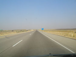
| Interestingly, today started off with a bit of an odd sight - an airplane parked in the middle of nowhere right next to the interstate. Why it was there, I have no idea. | 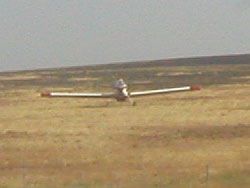 |
 |
We continued to follow Highway 20 for the entire day into Burns, and will continue following it tomorrow as we head to Newport, on the coast of Oregon. It's a little odd that we're somehow following four different routes at once, at least when headed west along I-84! |
| Now, for those of you who have never seen a Sonic ad, we see them constantly in Washington, despite that there's no Sonic anywhere close to us (except in Idaho). Now, being in Idaho, we decided it was high time to see what the hype was about. I wasn't really all that impressed with the structure, at least. The fruit shake Amanda ordered was okay, but somewhat on the average side when I tasted it. | 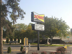 |
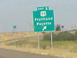 |
An odd thing happened on the way into Oregon - my camera would take the photos, but the photos would turn out completely white. Thus, I have no image of us crossing the Idaho-Oregon border (I tried), so I give you the photo before that - the last exit in Idaho before crossing the Idaho-Oregon border. It's fitting that my camera went fruity after Fruitland. |
| Getting across the border and through Ontario began the last leg of our journey into Burns along Highway 20, which has a lot of curves (much like our incoming route on Highway 12). Thankfully, these weren't curves that required you to slow down incessantly! |  |
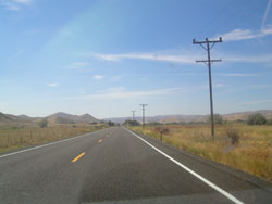 |
For some reason, the line of telephone poles heading off into the horizon alongside the road got my attention enough to snap a photo of it. There's some odd beauty in it for reasons I can't really identify. Crossing from the Mountain to Pacific time zones on Highway 20 actually was fairly easy, since there was a sign telling us we were crossing time zones. No such thing existed when going east on Highway 12, so we were a little confused when we hit civilization in Montana and saw all the clocks were an hour ahead. |
 We stopped for a very overpriced (and bland) lunch at Ye Olde Castle
in Burns, about a mile before we stopped at our hotel. Moon Handbooks
Oregon has the following to say about food in Burns:
We stopped for a very overpriced (and bland) lunch at Ye Olde Castle
in Burns, about a mile before we stopped at our hotel. Moon Handbooks
Oregon has the following to say about food in Burns:
"The culinary highlight of Burns is coffee in the deli at the Safeway on Monroe Street."
Not a good sign. We should've crossed the street according to this, since that's exactly where that Safeway is.
"A little west of Burns, a sign in Hines proclaims 'Worst Foods of the World - 70's Prices.'"
Sounding more dismal by the second.
"To be blunt, we think it's worth waiting until you get to Frenchglen to eat."
Zing!
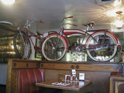
Now, if Frenchglen were actually on our route and not way off of Highway 20, maybe we would. I was hoping the handbook would be wrong, but there was one saving grace - Ye Olde Castle reminded me a lot of my boss at the Writing Center, since she collects mid-50's memorabilia and sells it.
We're staying at the Best Inn America in Burns (previously known simply as Best Inn), which Amanda thinks is the nicest hotel we've stayed at to date, at least in terms of the quality of their swimming pool. Personally, I thought the Best Western last night was good for the amount of space we were given, though it didn't have wireless access throughout the hotel (I had to be close to the office, and that meant being poolside so that I didn't have to actually be in the office - it had a very pretty, but very dead-insect-infested, pool).
Tomorrow, we head to Newport, OR through Bend and Corvallis. I attended the 2006 Pacific Northwest Writing Centers Association Conference at Oregon State University in Corvallis back in April and fell in love with the campus - we'll see if second impressions hold up.